Accurate 3D Laser Scanning and BIM modelling
Unlock every detail before you build—fast, precise, and reliable 3D scanning.
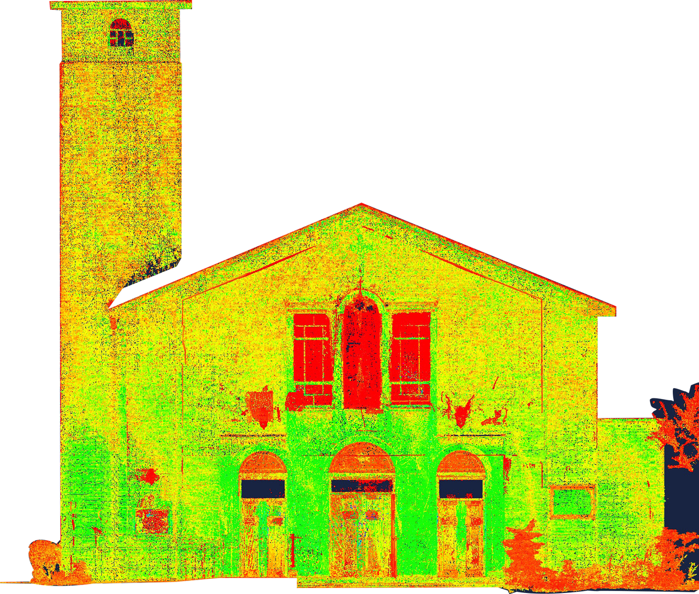
Accuracy matters. Whether you’re designing, renovating, or constructing, 3D laser scanning delivers millimetre-perfect data without the risk of human error. Using cutting-edge LiDAR (Light Detection and Ranging) technology, we provide high-resolution point cloud data, as-built CAD drawings, and BIM models, ensuring you get faster, more reliable insights for planning and construction. Minimise costly mistakes, reduce project delays, and get the exact data you need – first time, at scale.
Our 3D laser scanning services. Speak to an expert now for a fast quote: 07730 591 665
Point Cloud Surveys: High-resolution 3D scans capturing every structural and spatial detail with millimetre precision.
As-Built CAD Drawings: Convert scan data into accurate 2D plans, elevations, and cross-sections for design and planning.
BIM Modelling: Detailed 3D models in Revit and other BIM formats, ensuring seamless integration into architectural and engineering workflows.
Heritage & Conservation Scanning: Non-intrusive laser scanning for historic and listed buildings, preserving intricate details for restoration projects.
Structural & Deformation Analysis: Detect movement, settling, or warping in buildings to prevent future structural issues.
Clash Detection: Identify conflicts between design plans and real-world conditions, reducing errors in construction.
360° Reality Capture & Digital Twins: Create fully interactive digital replicas of buildings and sites for remote inspection and project planning.
Any building. Any size.
Any mainland UK location.
Surveying London & beyond
-

0% Human Error
Advanced 3D laser scanning for precision data
-

Fast response times
Rapid availability across London & UK
-

2D & 3D as-built drawings
Delivered in CAD, Revit & BIM formats
-

Experienced Surveyors
Trusted by industry professionals
Why 3D Laser Scanning & Modelling is essential
Featured projects
FAQs
-
3D laser scanning is a high-precision surveying method that captures detailed measurements of buildings, structures, and landscapes. It creates a point cloud, a digital 3D model that accurately represents the scanned environment, which can be converted into as-built CAD drawings, BIM models, and other formats for design, construction, and analysis.
-
3D laser scanning provides millimetre-accurate data, reducing errors and rework in architectural design, construction, renovations, and heritage preservation. It’s faster and more detailed than traditional surveying methods, making it essential for complex projects.
-
✔ Unmatched Accuracy: Captures precise spatial and structural details with 0% human error.
✔ Rapid Data Collection: Millions of data points scanned in seconds, saving time and reducing site visits.
✔ Seamless Integration: Data can be converted into CAD, Revit, and BIM models.
✔ Non-Intrusive Method: Ideal for occupied buildings, historic sites, and sensitive environments.
✔ Better Project Planning: Ensures reliable data for extensions, refurbishments, and structural assessments.
-
Architectural & Engineering Design: As-built models for planning and project coordination.
Heritage & Conservation: Capturing intricate details of historic buildings for restoration.
Residential & Commercial Renovations: Accurate floor plans and structural assessments.
Construction & Site Monitoring: Ensuring project accuracy and tracking progress.
Structural Deformation & Movement Analysis: Detecting shifts in buildings over time.
-
We use state-of-the-art laser scanners capable of capturing data with millimetre precision, ensuring highly detailed and reliable measurements.
-
Scanning time depends on project size and complexity, but most on-site scans are completed within a few hours. Processed data is typically delivered within 5–7 working days.
-
We deliver data in point cloud (.E57, .RCP, .LAS), CAD (.DWG), Revit (.RVT), and PDF formats, ensuring compatibility with leading architectural and engineering software.
-
Get a fast, accurate survey today: 07730 591 665 or email us at: info@measuredbuildingservices.co.uk